Thursday, April 28, 2011
tree hugging hippies
http://www.facebook.com/photo.php?fbid=10150170318658601&set=a.10150170316558601.283378.654923600&type=1&theater
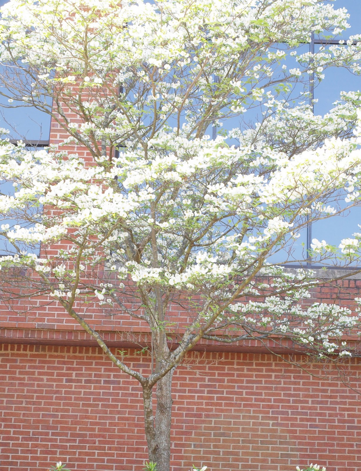
Southern pine beetle!!
The southern pine beetle is actually quite small and is incredible destructive to all species of yellow pine. It destroys the trees by laying egg nests underneath the bark which ultimately inhibit the tree from being able to transport water and nutrients within itself. Since 1972 the southern pine beetle has killed almost 250 million dollars worth of pine trees! Apparently the appearances of the SPB is cyclical and epidemic most often occurring around times of drought or flooding ironically. Apparently, long leaf pine is the most resistant to souther pine beetle attack.


Olcmulgee National Monument
These preserved mounds were built by the Mississipian culture of native Americans somewhere around 1000 years ago. However, it wasn't deemed a National Monument until the 1930s when construction workers stumbled upon archaeological evidence of 8 separate mounds while digging. Today the most prominent sites there are the great temple mound which was likely used for religious ceremonies and the earth lodge, a gathering place for what were probably the tribe's leaders that is literally carved out of the earth. There are also multiple burial mounds.


Tuesday, April 5, 2011


Tuesday, March 29, 2011
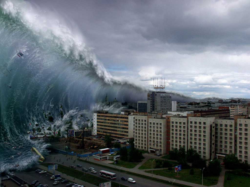
TSUNAMIS
Tsunamis are gigantic waves caused by mass displacements of water out at sea. When water levels are shifted due to underwater tectonic activity, explosions, or even meteors crashing then the displaced water forms a wave which gains speed and amplitude as it approaches shallow coastal water. Tsunamis are not the same as rogue waves which are caused by different means and usually occur far out at sea. They can devastate coastal communities especially in JapN which has almost 200 recorded incidents of tsunamis.


I'm not sure if this is actually a tsunami but it's an awesome video so I'm going to post it
http://www.youtube.com/watch?v=AlPqL7IUT6M&feature=youtube_gdata_player

I'm not sure if this is actually a tsunami but it's an awesome video so I'm going to post it
http://www.youtube.com/watch?v=AlPqL7IUT6M&feature=youtube_gdata_player
Tuesday, March 1, 2011
SOILS!
The 12 soil orders of the world are here.
One of the most prominent and the proposed state soil of Georgia is the Tifton Soil Series which is in the Ultisol soil order.

The Munsell Soil Chart is how we identify and categorize different soils. It is broken down into three aspects of the soil coloration, the Hue (or the basic color of the soil, i.e. red, yellow, green, blue, purple), the Value (or the lightness or darkness of the coloration), and the Chroma (or the saturation/ intensity of the color).


One of the most prominent and the proposed state soil of Georgia is the Tifton Soil Series which is in the Ultisol soil order.
Tifton Soil Profile
Surface layer: dark grayish brown loamy sand
Subsoil - upper: strong brown fine sandy loam
Subsoil - middle: yellowish brown sandy clay loam
Subsoil - lower: strong brown sandy clay
There is more than 5 percent plinthite in the subsoil
Surface layer: dark grayish brown loamy sand
Subsoil - upper: strong brown fine sandy loam
Subsoil - middle: yellowish brown sandy clay loam
Subsoil - lower: strong brown sandy clay
There is more than 5 percent plinthite in the subsoil
(http://urbanext.illinois.edu/soil/st_soils/ga_soil.htm)

The Soil Texture Dichotomous Key is a battery of questions one answers about a soil while examining it when wet. This helps to further identify it. An example of a soil texture dichotomous key is here.
This is an example of a soil texture diagram:

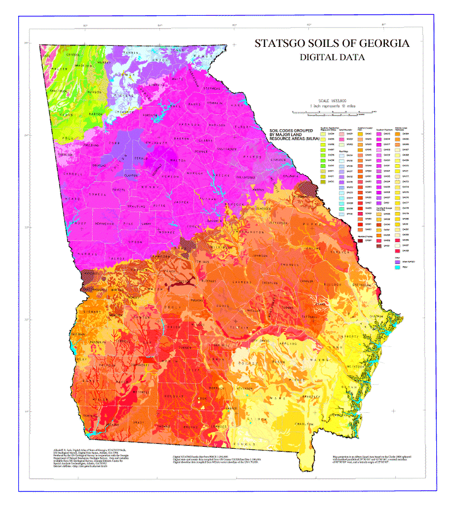
Finally, here's a soil map of Georgia!
Tuesday, February 8, 2011
GEOCACHING

Geocaching is a growing modernized scavenger hunt involving tiny trinkets hidden all over the world and identified by GPS coordinates. It creates an entirely new way to explore new and familiar environments. When a geocaher finds the gem he/she has been searching for, there are ways to prove he/she did so including anything from simply signing a piece of paper in a small jar, or solving a riddle and posting the answer on the geocaching website. It's not only educational, but fun too!
Not only has GPS technology created a fun way for us bored college students to wander around looking for hidden things, but it also poses to be a great aid to environmental research. Today marine biologists are tagging sharks with GPS locators to monitor their behaviors and migrations patterns. This allows us to no only have potentially safer beaches, but also understand the animals in entirely new ways.
http://video.foxnews.com/v/4373343/gps-devices-used-to-track-sharks/
http://www.geocaching.com/
Subscribe to:
Posts (Atom)